How GPS Pins Help You Remember Productive Sites
Your memory loses your best detecting spots. Here is how GPS pins help you revisit productive ground — without exposing your sites to anyone else.
Updated
You find a great patch — three coins in a ten-metre stretch — and you swear you’ll remember exactly where it was. Then life happens, a few weeks pass, and you’re standing in the same field with no idea which corner produced. It’s one of the most common frustrations in detecting, and it’s completely avoidable.
A GPS pin fixes it. Here’s how to use pins well, and how to keep them private.
Memory is the problem. Pins are the fix.
Your brain is bad at storing locations. It remembers “near the big tree” and loses the other forty metres of detail. A site that gave up good finds deserves better than a vague mental note.
Dropping a GPS pin the moment you find something means you can return to the exact spot — not the general area. That matters more than it sounds, because productive ground is almost never the whole field. It’s a hot corner, an old path, the lip of a slope. Pin it and you can work it methodically next time instead of re-searching from scratch.
Pin the right things
Not every pin means the same thing. It helps to think in three layers:
- Find locations — the precise spot a target came out. These build a map of where the good stuff actually is.
- Hunt areas — the broader zone you covered that day, so you know what ground you’ve already worked.
- Future intent — spots you spotted but didn’t get to, or areas worth a return visit.
Keeping these distinct stops you re-walking ground you’ve already cleared and points you straight at the unfinished promising patches.
Be realistic about accuracy
A pin is not a laser. Setting expectations properly here saves a lot of confusion later.
Under open sky, a modern phone will usually put you within a few metres of the truth. That is genuinely useful — it is the difference between “somewhere in this eight-acre field” and “this corner, within a couple of swings”. It is not the same as marking the hole.
Accuracy gets worse in predictable places. Dense tree cover blocks satellites. Valleys and steep banks cut off part of the sky. Buildings and walls cause signals to bounce, which can throw a pin further off than open-ground error ever would. Woodland and old farmyards — both excellent detecting ground — happen to be two of the worst environments for it.
A few habits tighten things up:
- Stand still for a few seconds before you drop the pin. Phones average recent readings, and a moving phone gives a smeared position.
- Have the phone out and in the open, not buried in a pocket against your leg.
- Pin from the clearest sky you can reach, then note the offset — “four metres north of the pin, at the base of the hedge” beats a confidently wrong dot.
- Check the accuracy figure if your app shows one. A reading claiming twenty metres is telling you something useful about how much to trust it.
A pin without a note is just a dot
This is the mistake that quietly wastes the whole practice. Six months on, forty anonymous pins across a permission tell you almost nothing.
What turns a dot into information is a line or two of context recorded at the same moment: what came out, how deep, what the ground was doing, and anything about the spot worth remembering. “Georgian button, 15 cm, on the slope above the old track, ground very stony” is a pin you can act on. A bare coordinate is a pin you will squint at and ignore.
The same applies to the negative results. Marking where you found nothing is unglamorous and genuinely valuable — it stops you spending next spring re-covering barren ground because it looked promising from the gate.
Findspots matter beyond your own records
There is a second reason to pin accurately that has nothing to do with your convenience.
An object with no findspot is a curiosity. The same object with an accurate location becomes evidence — it can be plotted against other finds, related to landscape features, and used to identify a site nobody knew was there. If you detect in the UK, this is exactly what a Finds Liaison Officer will ask you for, and a decent grid reference is the difference between a record that contributes something and one that does not. Our UK law guide covers the recording side properly; in Australia, the same logic applies to anything you need to report, as set out in the Australian rules guide.
The practical point is the same either way: record it in the field, at the moment of recovery. Reconstructing a findspot from memory a fortnight later produces a guess wearing the costume of a fact.
How pins make you more efficient
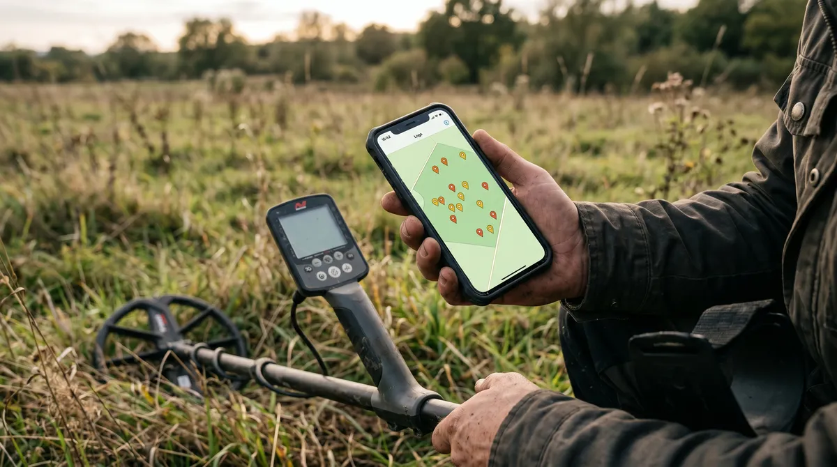
Over a season, your pins turn into a coverage map. You can see at a glance which parts of a permission you’ve hammered and which you’ve barely touched. That’s the difference between wandering and working a site — fewer wasted swings, more time over ground that’s actually producing.
Tie those pins to your finds and you get even more: the productive zones light up as clusters, and your stats can rank locations by keeper rate. Your logbook becomes a strategy map.
Clusters are worth taking seriously when they appear. Three good finds in a ten-metre stretch is rarely coincidence — it usually means something was there: a path, a gateway, a building, a gathering place. That pattern is invisible in a notebook and obvious on a map, and it is often the thing that turns an average permission into a good one.
Practical field notes
Rural sites have no signal, and that is fine. GPS positioning does not need a mobile connection — the satellites work regardless. Map tiles do need data, so download offline maps for the area before you leave if you want to see where you are rather than just record it.
Watch your battery. Continuous location use is one of the heavier things a phone does. On a long hunt in cold weather, a power bank is the difference between a full set of pins and losing the afternoon’s records at the point they became interesting.
Know how to read out a location. If you ever need to give a position to someone else — a landowner, a heritage officer, or emergency services — being able to produce a plain grid reference or coordinate pair from your phone is a genuinely useful skill. It is worth finding that screen once, calmly, rather than for the first time in an emergency.
Keep your spots private
Here’s the part too many detectorists get wrong: a precise location is sensitive information. Post a productive coordinate publicly and you can expose a site, breach a landowner’s trust, and invite others onto ground that isn’t theirs to search.
So treat pins as private by default. In DetectingLog, your locations stay on your device unless you choose to enable cloud sync, and even then they’re protected so only your account can read them. There’s no public feed, no sharing your spots by accident. If you ever do share, share a general area — never the exact pin. We go deeper on this in the privacy guide.
Open the spot when you need it
A saved pin isn’t much use if you can’t get back to it. The practical workflow is simple: save the location in the field, then when you’re planning a return, open it in your phone’s maps to navigate straight there. No landmarks, no guesswork, no “I think it was over here.”
The bottom line
Your best sites are worth protecting and worth returning to. GPS pins let you do both — capture the exact spot, keep it private, and walk straight back to productive ground on your next hunt.
Frequently asked questions
Why use GPS pins for metal detecting?
Because memory fails. A productive patch is usually one small corner of a larger site, and weeks later you won't recall exactly where. A GPS pin takes you back to the precise spot so you can work it properly instead of guessing.
How accurate is a phone GPS for marking a find?
Under open sky a modern phone is typically accurate to within a few metres, which is close enough to bring you back to the right patch of ground. Accuracy degrades under tree cover, beside buildings, and in valleys, so pin in the open where you can and add a short note as a backup.
Are my saved detecting locations private?
In DetectingLog they are. Your pins stay on your device by default and are never shared or made public. Cloud sync is optional and protected so only your account can read your locations. Your spots stay yours.
Should I share my metal detecting GPS coordinates?
Generally no. Exact coordinates of a productive private site can expose it to others, breach a landowner's trust, or put finds at risk. Keep precise pins to yourself and only ever share a general area if you choose to share at all.
Keep reading
Digging and Recovery: Cut a Clean Plug, Leave No Trace
Recovery is the skill that decides whether you keep your permissions. Tools, plug technique by ground type, and how to get the target out undamaged.
Trash vs Treasure: Improve Your Keeper Rate Over Time
Digging junk is part of detecting — but patterns can cut the wasted digging. Here is how to raise your keeper rate without missing the good finds.
Metal Detecting Data: Spot Patterns Across Your Hunts
Finds per hunt, keeper rate, top locations, VDI distribution, depth bands — here is how simple stats reveal patterns your memory would miss.